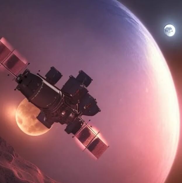
Explore the multifaceted significance of satellites in our modern world. Learn how satellites contribute to global communication, weather forecasting, navigation, and scientific research. Discover their pivotal role in national security and defense systems, providing surveillance, intelligence, and communication capabilities.
Satellites are elements that orbit around a certain celestial body. There are natural satellites and artificial satellites, that is, created by man to satisfy his needs. In the first case, a paradigmatic example is that of the moon, which revolves around the Earth and together with it makes a tour around the sun; in the second, we have the infinity of satellites that were created since the mid-twentieth century to perform military tasks, communications, research, etc. Certainly, in both cases there is a clear interest for man and this circumstance makes us appreciate its importance.
From the point of view of natural satellites, they have influence on some natural phenomena that operate on the planets on which they orbit. In the case of our moon, it has an evident relationship with the tides, a fact that is known since remote antiquity. Fundamentally, this phenomenon is due to the attraction that the moon has on the surface of the water and that makes it covers greater or lesser portions of the coast according to its position. The tides can affect fishing and are also used for processes of obtaining energy, situations that account for their importance and the importance of our natural satellite.
However, from the perspective of artificial satellites, they were developed in response to various problems that affect man. The conception of them began to develop at the beginning of the 20th century and over time it was deepened until it was possible in the second half of the last century to launch one. The first satellite placed in orbit corresponded to a project of the Soviet Union and this fact made the United States take seriously the space race, soon after also achieving its own satellites. Nowadays, this type of elements are used for the most varied functions, standing out among them the one related to the communication and the observation of the earth for the elaboration of maps, the geolocation, etc .; Research also makes use of them when they are used to observe other celestial bodies more effectively.
As we see, satellites have a great influence on our lives, whether we are referring to the natural as to the artificial. In this last case we will undoubtedly see a lot of new variants in the future that will significantly improve our quality of life.
How do satellites contribute to global communication and internet connectivity?
Satellites play a crucial role in global communication and internet connectivity through their ability to relay signals over vast distances. They are used for various purposes, including broadcasting television and radio signals, providing broadband internet access, and enabling long-distance telephone communication. Communication satellites orbit the Earth at specific positions, known as geostationary orbits, which allows them to remain fixed over a particular point on the Earth’s surface. This characteristic enables consistent and reliable communication coverage over large regions. These satellites receive signals from ground-based transmitters, amplify them, and then transmit them back to Earth to be received by devices like satellite dishes or communication towers. This technology has greatly expanded global connectivity and made communication possible in areas that are otherwise challenging to reach through traditional means.
What role do satellites play in weather forecasting and monitoring climate patterns?
Satellites play a crucial role in weather forecasting and monitoring climate patterns by providing a comprehensive view of Earth’s atmosphere and surface from space. They contribute to these fields in several ways:
- Data Collection: Satellites gather a wide range of data, including temperature, humidity, wind patterns, cloud cover, and sea surface temperatures. This data is used to create accurate weather forecasts and track climate changes over time.
- Global Coverage: Satellites offer a global perspective, allowing meteorologists and climate scientists to monitor weather systems and climate patterns across different regions simultaneously.
- Timely Information: Real-time data from satellites helps meteorologists predict severe weather events such as hurricanes, typhoons, and tornadoes, enabling authorities to issue timely warnings and minimize potential damage.
- Climate Monitoring: Satellites provide long-term data sets that help scientists analyze climate trends, including changes in sea levels, ice cover, and temperature patterns. This information is vital for understanding the impacts of climate change.
- Early Warning Systems: Satellite data helps in the early detection of environmental changes that may lead to disasters like droughts, floods, and wildfires. This allows governments and organizations to take proactive measures to mitigate the impacts.
- Research and Analysis: Scientists use satellite data to study the Earth’s climate system, identify patterns of change, and develop models that can predict future climate scenarios.
- Ocean Monitoring: Satellites track ocean currents, temperature variations, and sea surface heights, contributing to our understanding of ocean circulation, which has a significant impact on global weather and climate patterns.
In summary, satellites provide an invaluable tool for monitoring and understanding Earth’s weather and climate, aiding in accurate forecasting and providing essential information for addressing climate-related challenges.
In what ways do satellites assist with navigation and GPS technology?
Satellites play a fundamental role in navigation and GPS (Global Positioning System) technology by providing accurate and real-time positioning information. Here’s how satellites assist in navigation and GPS:
- Triangulation: GPS satellites work together to determine a receiver’s precise location on Earth using a process called triangulation. By receiving signals from multiple satellites, a GPS receiver can calculate its distance from each satellite and then triangulate its position based on the intersections of these distances.
- Positioning Accuracy: GPS satellites provide highly accurate positioning information, typically within a few meters. This accuracy is crucial for various applications, including driving navigation, aviation, maritime navigation, and surveying.
- Real-time Updates: GPS satellites continuously transmit signals that include information about their location and the precise time the signal was sent. GPS receivers use this information to calculate their position and update it in real time as the user moves.
- Navigation Systems: GPS technology is integrated into navigation systems used in vehicles, airplanes, ships, and smartphones. These systems provide users with turn-by-turn directions, route optimization, and real-time traffic updates.
- Emergency Services: GPS enables emergency services to accurately locate individuals in distress, such as in the case of a 911 call from a mobile phone. This capability can save lives by speeding up response times.
- Precision Agriculture: GPS technology is used in precision agriculture to guide tractors, drones, and other equipment with high accuracy, optimizing crop planting, fertilization, and harvesting processes.
- Geocaching and Recreation: GPS technology is used for geocaching, a recreational activity where participants use GPS coordinates to find hidden “caches.” It’s also widely used in outdoor activities like hiking, camping, and orienteering.
- Scientific and Surveying Applications: GPS is used in scientific research, land surveying, and mapping to accurately measure distances, elevations, and positions of landmarks and features.
- Time Synchronization: GPS satellites transmit highly accurate time information, which is essential for synchronizing various systems, networks, and devices worldwide.
In essence, satellites in the GPS constellation provide the signals and information necessary for accurate positioning and navigation, enabling a wide range of applications that have become integral to modern society.
How do satellites aid in scientific research and data collection in remote areas?
Satellites aid scientific research and data collection in remote areas by providing a platform for collecting information from regions that are difficult or inaccessible for direct observation. Here’s how satellites contribute to these efforts:
- Remote Sensing: Satellites equipped with various sensors and instruments can capture data about Earth’s surface, atmosphere, oceans, and even outer space. These sensors can measure properties such as temperature, moisture, vegetation health, pollution levels, and geological features.
- Global Coverage: Satellites offer a global perspective, allowing scientists to monitor changes in remote areas that might otherwise be challenging to access regularly. This is particularly valuable for monitoring remote ecosystems, polar regions, and remote islands.
- Consistent Monitoring: Satellites can provide consistent, frequent, and repeatable observations over time. This is especially important for tracking changes in the environment, such as deforestation, glacier melting, and sea level rise.
- Disaster Assessment: Satellites are used to assess the impact of natural disasters such as earthquakes, hurricanes, and wildfires in remote areas. The data they provide helps authorities coordinate relief efforts and make informed decisions.
- Wildlife Tracking: Scientists use satellite tags and tracking devices to monitor the movements and behaviors of animals in remote environments. This information contributes to wildlife conservation and understanding ecosystem dynamics.
- Oceanography: Satellites play a crucial role in monitoring ocean currents, sea surface temperatures, and marine life distribution. This data aids in understanding climate patterns, ocean circulation, and the health of marine ecosystems.
- Glacier and Ice Sheet Monitoring: Satellites track changes in ice sheets and glaciers in remote polar regions. This information is vital for studying the impacts of climate change on these areas and predicting sea level rise.
- Archaeological Exploration: Satellite imagery is used for archaeological research, helping identify ancient ruins, buried structures, and other features that are not easily visible on the ground.
- Environmental Research: Satellites contribute to scientific studies on air and water quality, deforestation, land use changes, and pollution levels in remote or inaccessible locations.
- Space Exploration: Satellites themselves are used for scientific exploration of outer space, providing data on celestial bodies, cosmic phenomena, and the universe’s origins.
In summary, satellites provide a means to gather data from remote areas that would otherwise be challenging to reach, offering scientists insights into various natural processes, environmental changes, and the behavior of Earth’s ecosystems.
What is the significance of satellites in national security and defense systems?
Satellites play a crucial role in national security and defense systems due to their ability to provide critical information, communication, and surveillance capabilities. Here’s why satellites are significant in this context:
- Surveillance and Intelligence: Satellites equipped with high-resolution imaging and remote sensing technologies can monitor activities on the ground, providing valuable intelligence for defense and security agencies. This includes tracking potential threats, monitoring military movements, and identifying suspicious activities.
- Early Warning Systems: Satellites contribute to early warning systems for missile launches, nuclear tests, and other potential threats. This information allows governments to assess the situation quickly and respond appropriately, enhancing national security.
- Communication: Military satellites facilitate secure and reliable communication between various defense units, including troops, vehicles, ships, and aircraft. These communication channels are vital for coordination, command, and control in military operations.
- Navigation and Targeting: Satellite-based navigation systems like GPS are essential for accurate navigation and targeting of military assets, ensuring precision in operations, such as airstrikes, missile launches, and ground operations.
- Situational Awareness: Satellites provide real-time situational awareness by offering a comprehensive view of events occurring across the globe. This information aids decision-makers in assessing threats, evaluating risks, and planning responses.
- Monitoring Borders and Maritime Areas: Satellites assist in monitoring borders, coastal regions, and maritime areas, helping to detect and counter illegal activities such as smuggling, piracy, and unauthorized border crossings.
- Disaster Response: Satellites play a role in disaster response and recovery efforts by providing imagery and data that aid in assessing damage, planning rescue missions, and coordinating relief efforts in affected areas.
- Crisis Management: Satellite imagery and data are invaluable during crisis situations, allowing authorities to assess the extent of damage, identify safe zones, and coordinate evacuation plans.
- Cybersecurity: Satellites support secure communication channels that are essential for preventing cyber threats and ensuring the protection of sensitive military information.
- Strategic Planning: Satellite data supports long-term strategic planning by providing insights into global geopolitical trends, resource availability, and potential areas of conflict.
In essence, satellites enhance national security and defense capabilities by providing timely, accurate, and actionable information that enables governments to make informed decisions, protect their citizens, and maintain control over their military operations.
