What is gulf stream? Where is gulf stream? What are the effecst and causes of gulf stream? Information on gulf stream.
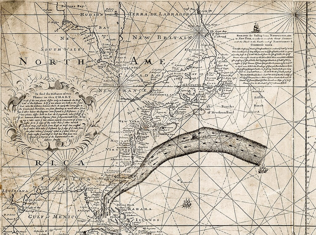
Benjamin Franklin’s chart of the Gulf Stream printed in London in 1769 (Source: wikipedia.org)
Gulf Stream; a strong ocean current that flows north in the western North Atlantic Ocean, 10 to 500 miles (16 to 800 km) east of the coast of the United States. The name originated in the 16th century and reflected the belief that the current was generated in the Gulf of Mexico. Although it is now known that this is not true, the name remains in international use.
The Gulf Stream is not, as commonly thought, a “river of hot water” but is instead a narrow, high-velocity flow that separates the cold, dense water on its left from the warm waters of the Sargasso Sea on its right. The name generally is applied to currents running from the Straits of Florida to the Norwegian Sea, but more properly it should denote the current extending from the Straits of Florida as far as an area off the Grand Banks at about 40° N latitude and 50° W longitude. East of this area the current becomes less distinct and is renamed the North Atlantic Current.
Knowledge of the general position of the Gulf Stream and related North Atlantic currents has been of great importance to man. Navigators use the Gulf Stream when going from North America to Europe by steaming along with the current, thus saving time and fuel. On the return voyage the navigators avoid the stream.
Effects on Climate:
It has been a generally accepted view that the Gulf Stream directly modifies the climate of Europe. However, scientists have determined that it is not the stream itself but the position of the warm water it encloses— that is important. Thus, while the stream determines the northern boundaries of this warm, central water mass, it is this North Atlantic central water mass itself which has the major influence on Europe’s climate. In fact, when there is an increase in the volume of water being transported by the stream, a cooling instead of a warming effect has been noted in Europe.
Flow of Water
The outstanding features of the Gulf Stream are its extreme narrowness (about 60 miles, or 100 km) and high velocity and the existence of a deep countercurrent. Little is known about the countercurrent except that it has a maximum speed of 7 inches or 18 cm, per second (0.4 mph). As the Gulf Stream first emerges from the Straits of Florida, it flows over the continental slope, restrained in a narrow band whose water depth is limited to about 2,600 feet (800 meters). The current velocity is as much as 4 mph, or 180 cm per second, and the current transport is 7 billion gallons (26 million cu meters) of water per second.
At about Cape Hatteras, the Gulf Stream begins to flow over the continental rise and grows deeper, extending down to 13,000 to 16,000 feet (4,000 to 5,000 meters). The water transport is about 22 billion gallons (82 million cu meters) per second. The current widens, no longer severely constrained by the ocean floor. It might be described as consisting of a number of meandering filaments that move laterally in the same general direction. The position of the filaments may be determined by standard vertical measurements of temperature and salt content or by surface features such as a sudden change in color, velocity, or number of whitecaps.
Contrast with Surrounding Waters
The warm, saline waters on the right and south of the current contrast sharply with the fresher, colder waters on its left. Surface temperatures in the Sargasso Sea remain at about 68° to 75° F (20° to 24° C), whereas the surface temperatures on the other side fluctuate between 54° and 68° F (12° and 24° C). The boundary between the Gulf Stream and the northern waters is well defined both at the surface and at depth and is called the “cold wall.” The level of water on the right of the stream is higher than on the left by about 30 inches (80 cm), not only because of the differing water masses but also because of the interaction of forces involved in the motion and distribution of low and high atmospheric pressure regions.
Gulf Stream Studies
Ships, drifting bottles, and even submarines are being used to study the Gulf Stream. Buoys, which are programmed to drift with the current at any desired depth, send their electronic impulses back to shipboard computers, where velocity, direction, and related water properties are analyzed. Current meters may remain at a desired depth for months, accumulating data on long-range variations of the stream.
Photographs taken at depths of thousands of meters show whether the current reaches the sea bottom and how much it disturbs the sediments there. Aircraft also are used to survey the stream; their instruments can determine the temperature boundaries of the stream over a long distance in a short time interval. The survey of the Gulf Stream still progresses rather slowly because of its large extent, but the techniques developed in this century have resulted in a better understanding of the whole circulation system of which the Gulf Stream is a part.
